|
Carlow County - Ireland Genealogical Projects (IGP TM)
Images of River Barrow Carlow
|
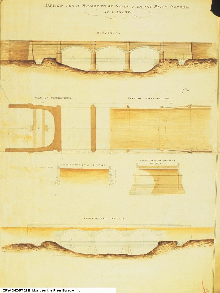 Office
of Public Works Plans, for bridge over the River Barrow, Carlow. Office
of Public Works Plans, for bridge over the River Barrow, Carlow.
|
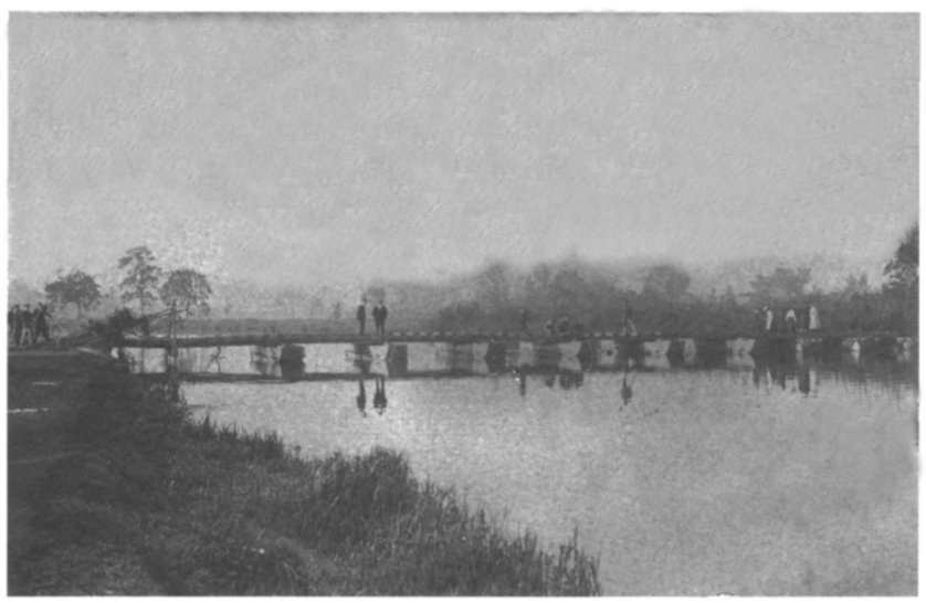 76. Jimmy 'Teraza' Murnane is
currently the Chairman of Carlow Urban District Council. On many
occasions Jimmy has stated: 'During my tenure on the council I intend
to see a second bridge built across the Barrow". Well, if Jimmy had
been around in 1914 (and some would say, he just had to be) he would
have seen a second bridge. This Bailey bridge was erected in 1914 at
the end of Montgomery Street as part of army/civilian manoeuvres. It
was possible to drive a light automobile or wagons across it. In this
picture we see men, women and soldiers strolling on the bridge, while
some boys avail of the opportunity to fish. 76. Jimmy 'Teraza' Murnane is
currently the Chairman of Carlow Urban District Council. On many
occasions Jimmy has stated: 'During my tenure on the council I intend
to see a second bridge built across the Barrow". Well, if Jimmy had
been around in 1914 (and some would say, he just had to be) he would
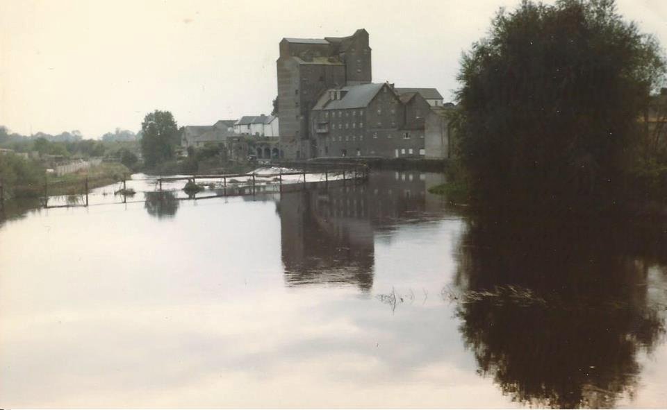
have seen a second bridge. This Bailey bridge was erected in 1914 at
the end of Montgomery Street as part of army/civilian manoeuvres. It
was possible to drive a light automobile or wagons across it. In this
picture we see men, women and soldiers strolling on the bridge, while
some boys avail of the opportunity to fish. |
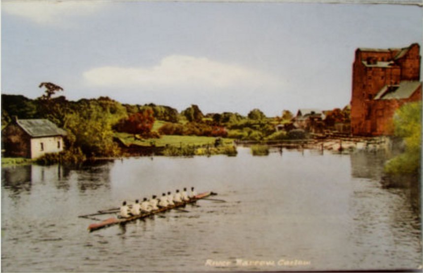
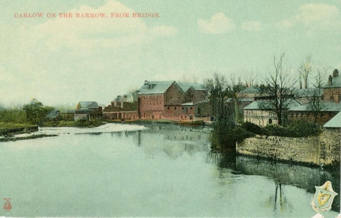
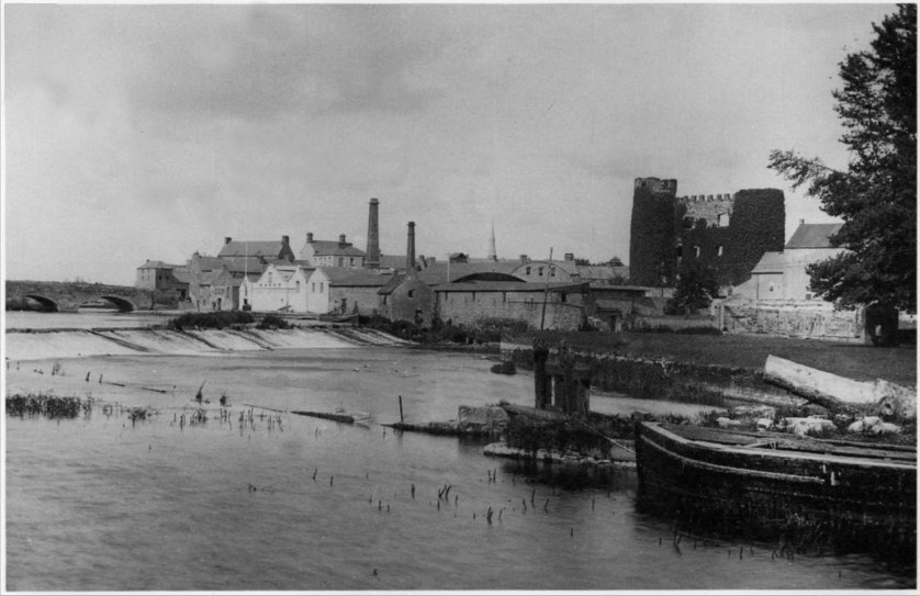 75. From Websters Lock in
Graiguecullen we get this view of the Carlow side of the river Barrow.
Graigue Bridge, the chimney stacks of Corcorans mineral factory, the
spire of St. Anne's, the ivy-clad castle and the river barges are all
landmarks of some of the areas we have covered in this volume. Outside
of a portion of the lighter coloured, pointed buildings, we can see a
group of people sitting at the Rowing Club premises; overhead is
the flag pole from which the club flag will fly during the annual
regatta. Just below the weir we can see the confluence where the
river Burrin joins the river Barrow 75. From Websters Lock in
Graiguecullen we get this view of the Carlow side of the river Barrow.
Graigue Bridge, the chimney stacks of Corcorans mineral factory, the
spire of St. Anne's, the ivy-clad castle and the river barges are all
landmarks of some of the areas we have covered in this volume. Outside
of a portion of the lighter coloured, pointed buildings, we can see a
group of people sitting at the Rowing Club premises; overhead is
the flag pole from which the club flag will fly during the annual
regatta. Just below the weir we can see the confluence where the
river Burrin joins the river Barrow |
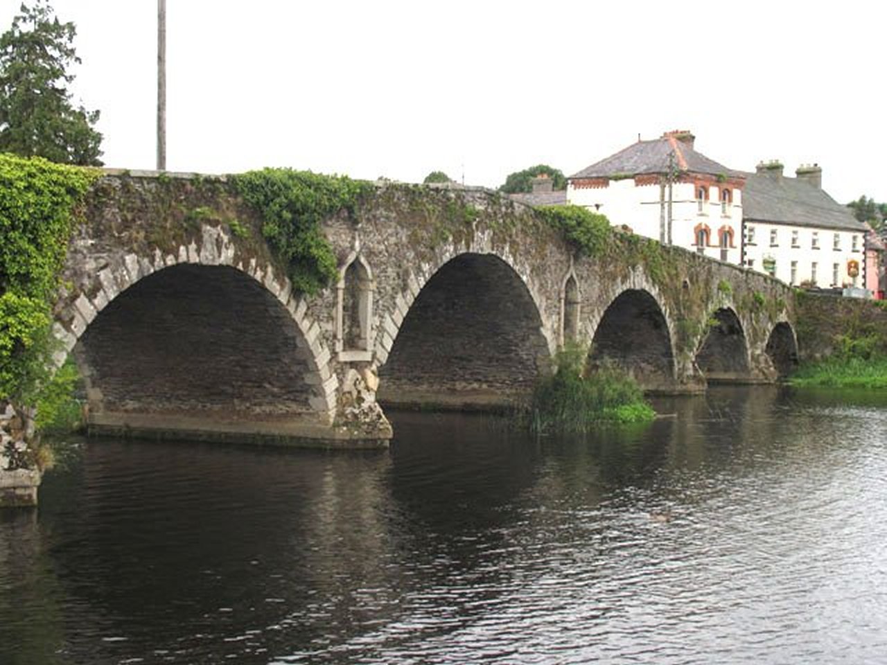
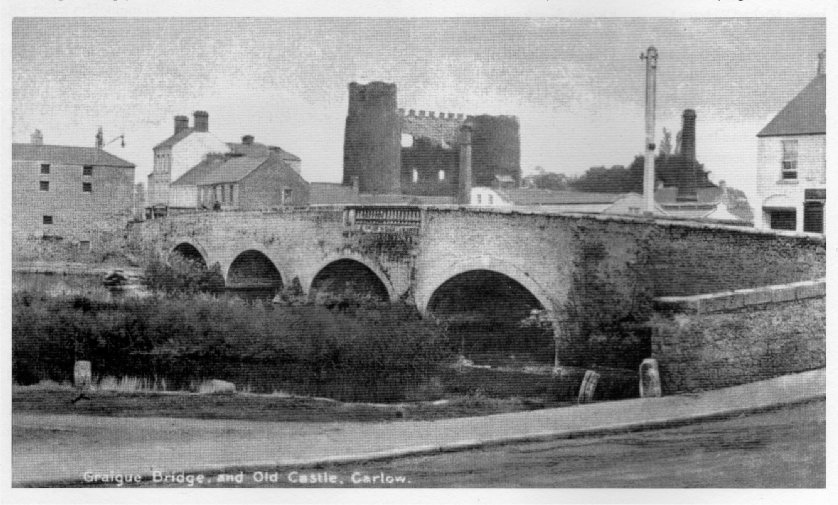
 68. Castle Quay situated at the edge
of the town. Early maps show a bridge erected at this point. It is
very difficult to trace the development of the town. We know that it
was destroyed many times, having suffered at least four major fires.
The first recorded fire occurred in June 1577, when Rory Oge O'Moore
attacked and burned what was at that time described as the fine and
large town of Carlow. During a siege in September 1641 the town was
again torched, with the loss of 74 lives. In June 1693 a great fire
occurred accidentally, the last recorded great fire broke out in 1698.
It should be remembered that most of the houses were thatched and
highly flammable. A legacy of those fires is that the old walls which
enclosed the town, cannot now be traced with any certainty. From two
early maps we can establish that the town developed to its present
format from about 1700. 68. Castle Quay situated at the edge
of the town. Early maps show a bridge erected at this point. It is
very difficult to trace the development of the town. We know that it
was destroyed many times, having suffered at least four major fires.
The first recorded fire occurred in June 1577, when Rory Oge O'Moore
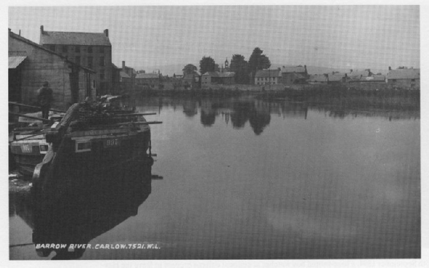
attacked and burned what was at that time described as the fine and
large town of Carlow. During a siege in September 1641 the town was
again torched, with the loss of 74 lives. In June 1693 a great fire
occurred accidentally, the last recorded great fire broke out in 1698.
It should be remembered that most of the houses were thatched and
highly flammable. A legacy of those fires is that the old walls which
enclosed the town, cannot now be traced with any certainty. From two
early maps we can establish that the town developed to its present
format from about 1700. |
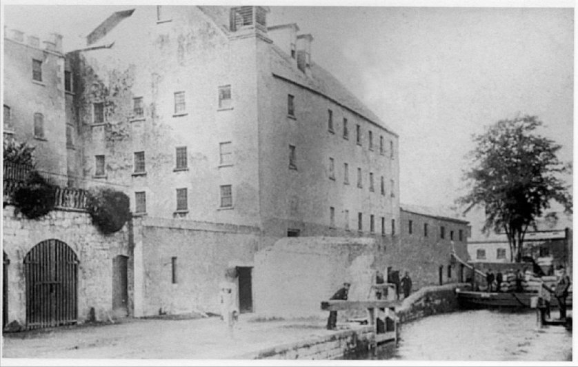
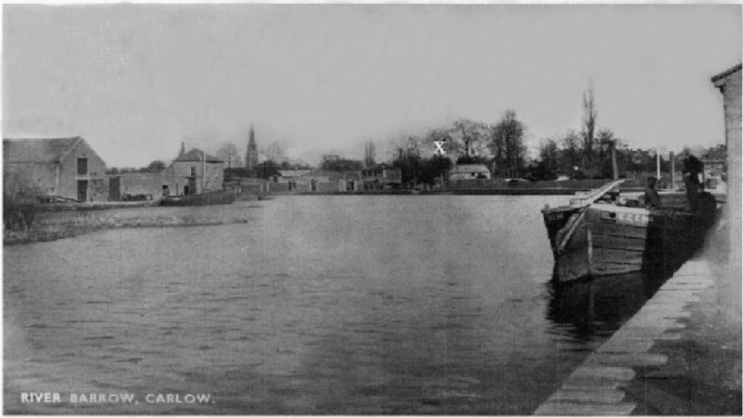 53. A very early picture of the
River Barrow. To the left, on the Graiguecullen side of the river, we
see the Barrow Navigation Company Stores with two docks for barges. In
1990 all this area was demolished and cleared and is being developed
as a community park. 'X' marks the stables belonging to the National
Bank, situated in the 'Bank field', where in later years carnivals
were held. It is now a car park. The spire of St. Anne's Church on the
Athy Road can be seen in the background. 53. A very early picture of the
River Barrow. To the left, on the Graiguecullen side of the river, we
see the Barrow Navigation Company Stores with two docks for barges. In
1990 all this area was demolished and cleared and is being developed
as a community park. 'X' marks the stables belonging to the National
Bank, situated in the 'Bank field', where in later years carnivals
were held. It is now a car park. The spire of St. Anne's Church on the
Athy Road can be seen in the background. |
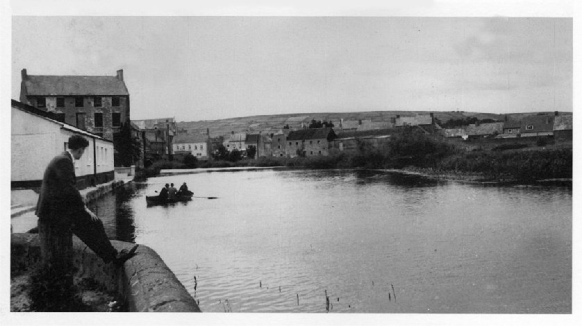 54. Looking in the opposite
direction of the previous picture we see the Killeshin hills in the
background. A lone figure watches as three men in a boat move down the
river. Seemingly Carlow Rowing Club is already established in the
light-coloured building on the left. The club purchased the Canal
Stores in March 1961 and after extensive refurbishment the new
clubhouse opened in 1962. The large building in the background was
built in the early nineteenth century as the Flyboat Hotel to cater
for boat passengers. 54. Looking in the opposite
direction of the previous picture we see the Killeshin hills in the
background. A lone figure watches as three men in a boat move down the
river. Seemingly Carlow Rowing Club is already established in the
light-coloured building on the left. The club purchased the Canal
Stores in March 1961 and after extensive refurbishment the new
clubhouse opened in 1962. The large building in the background was
built in the early nineteenth century as the Flyboat Hotel to cater
for boat passengers. |
|
|
 30. This picture is taken from the
Graiguecullen side of the river. The card posted in 1914 to Liverpool
simply states: Another view of the Castle. At the right we see a
portion of the Bridge shop which is built on an island. The building
served for a while as a convent for the enclosed religious order of
nuns, the Poor Clares. The chimney stacks belong to Corcoran's mineral
water factory. The large five-windowed building on the left is McWey's
grain store. 30. This picture is taken from the
Graiguecullen side of the river. The card posted in 1914 to Liverpool
simply states: Another view of the Castle. At the right we see a
portion of the Bridge shop which is built on an island. The building
served for a while as a convent for the enclosed religious order of
nuns, the Poor Clares. The chimney stacks belong to Corcoran's mineral
water factory. The large five-windowed building on the left is McWey's
grain store. |
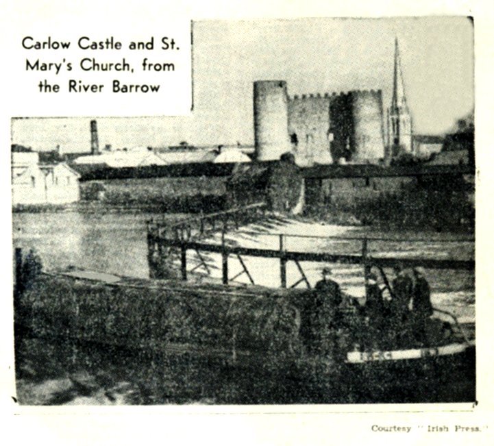
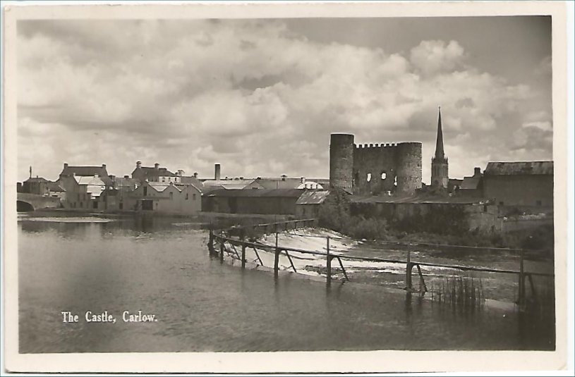
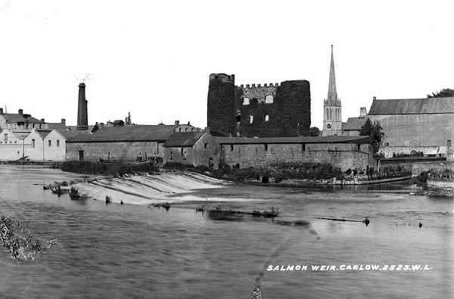
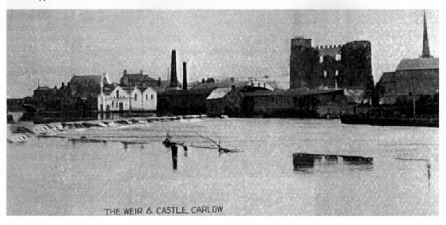 22. An enlarged view from a
multi-view postcard. With the Castle in the background the river
Barrow looks to be in flood. The caption states: 'Weir and Bridge
showing Castle Carlow." In this picture the weir appears to be nearer
to the bridge than it actually is. Indeed it would appear that the
photographer is standing alongside the gates, but I am sure that this
picture has been retouched, as the scene does not conform to other
views of the area that I have seen. 22. An enlarged view from a
multi-view postcard. With the Castle in the background the river
Barrow looks to be in flood. The caption states: 'Weir and Bridge
showing Castle Carlow." In this picture the weir appears to be nearer
to the bridge than it actually is. Indeed it would appear that the
photographer is standing alongside the gates, but I am sure that this
picture has been retouched, as the scene does not conform to other
views of the area that I have seen. |
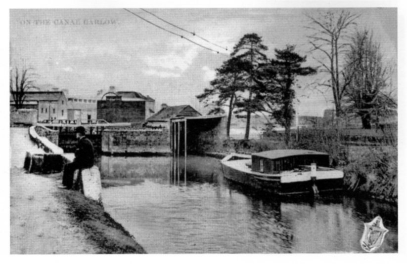
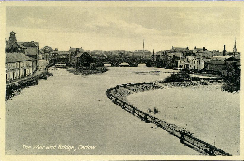
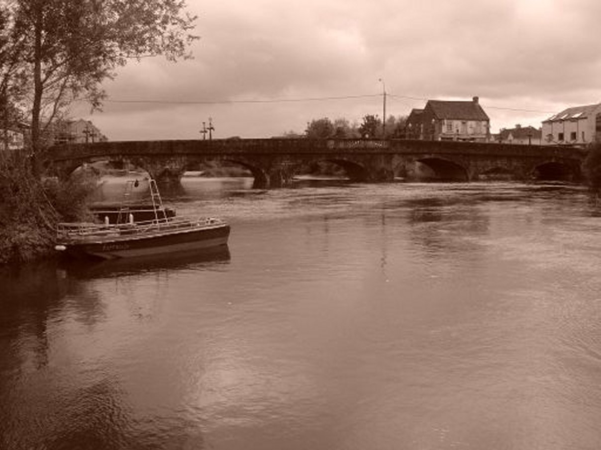
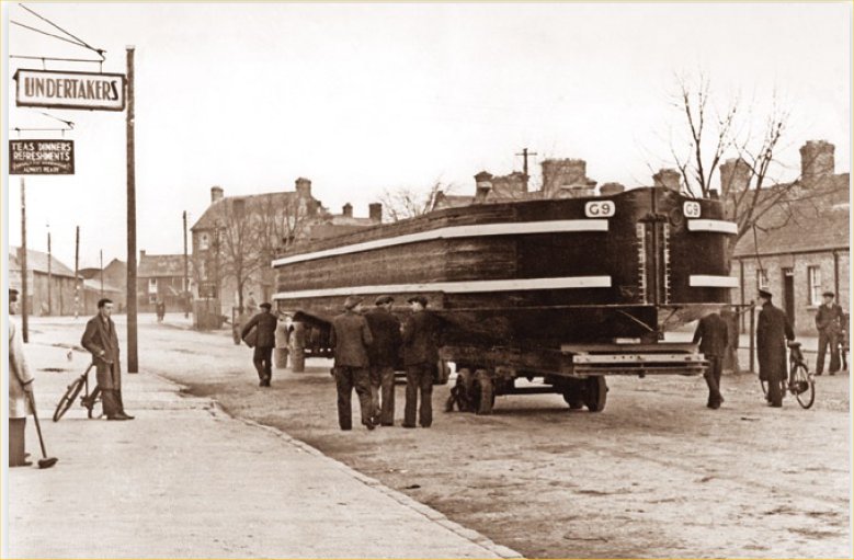
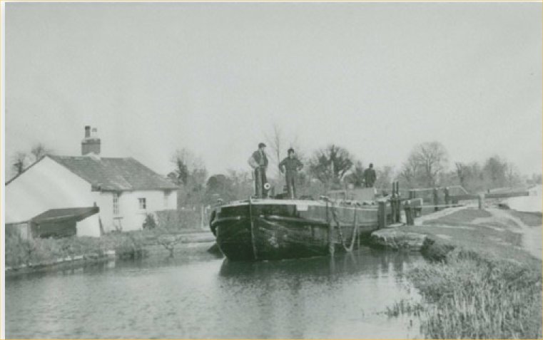
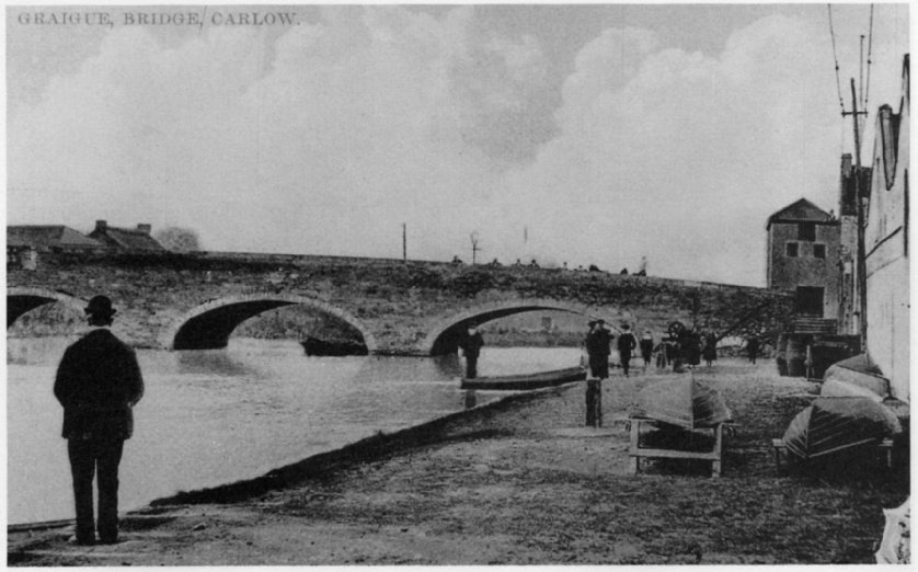
 64. Below the Haymarket we have this
view looking across the river Barrow. On our left a river barge owned
by James Ryan of Coalmarket is anchored by the side of the canal
store. The store was used by the Barrow Navigation Co. The building
was acquired in 1960 by Carlow Rowing Club for use as a club house.
The large building in the background was known as the Flyboat Hotel,
built in 1805 to cater for boat passengers, it was demolished in 1963.
To the rear of the Flyboat we can just about see a portion of Graigue
Bridge which links Carlow with the village of Carlow-Graigue, later
renamed Graiguecullen. In the centre view the bell tower of the parish
church, the chapel of ease can be seen; the large, lighter coloured
building to the right is the Parochial house. 64. Below the Haymarket we have this
view looking across the river Barrow. On our left a river barge owned
by James Ryan of Coalmarket is anchored by the side of the canal
store. The store was used by the Barrow Navigation Co. The building
was acquired in 1960 by Carlow Rowing Club for use as a club house.
The large building in the background was known as the Flyboat Hotel,
built in 1805 to cater for boat passengers, it was demolished in 1963.
To the rear of the Flyboat we can just about see a portion of Graigue
Bridge which links Carlow with the village of Carlow-Graigue, later
renamed Graiguecullen. In the centre view the bell tower of the parish
church, the chapel of ease can be seen; the large, lighter coloured
building to the right is the Parochial house. |
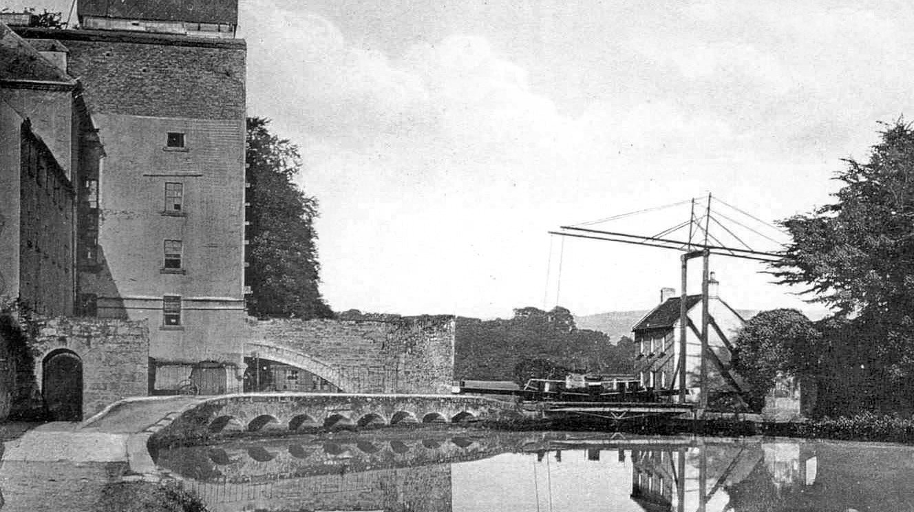
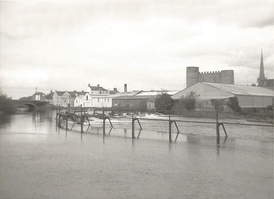
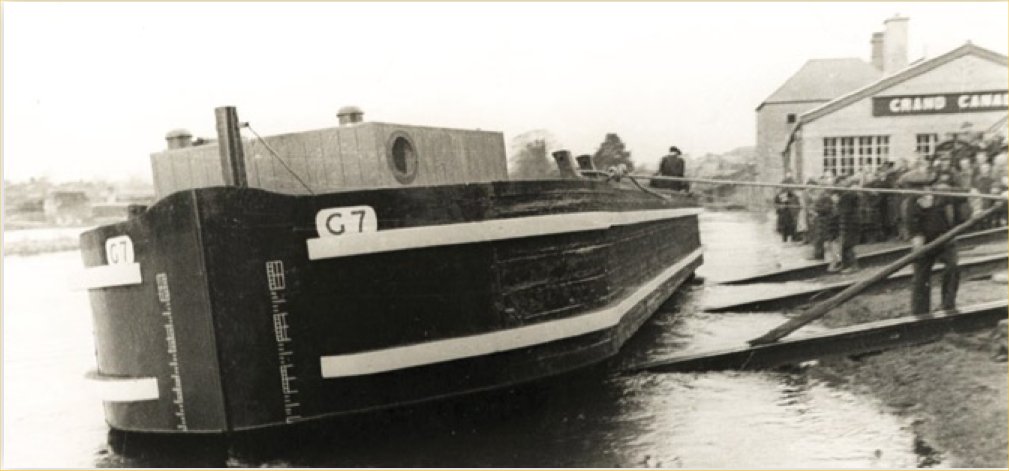
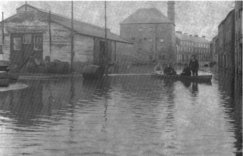 65. Looking in the opposite
direction of the previous view we can see that the Barrow has flooded
Cornwall Quay. On our left we can see 'Grand Canal Company' over the
office of the canal store. At the side of the entrance we can read:
'Boats to and from Dublin and Waterford and all intermediate
stations.' At the store gate it seems to be business as usual. The big
building with tall chimney in the background is 'the leek'; built in
1815 as Farrells malt house, it later became a dispatch office for
Milford flour mills. At the time this picture was taken it was
Alexanders electricity powerhouse. The row of houses is situated in
Ballymanus Terrace. On the right are Joshua Watson's grain stores. The
shop front on our immediate right is Farrells licensed premises. For
many years this area was subject to flooding, but recent flood control
measures undertaken by Carlow County Council seem to have solved the
problem. 65. Looking in the opposite
direction of the previous view we can see that the Barrow has flooded
Cornwall Quay. On our left we can see 'Grand Canal Company' over the
office of the canal store. At the side of the entrance we can read:
'Boats to and from Dublin and Waterford and all intermediate
stations.' At the store gate it seems to be business as usual. The big
building with tall chimney in the background is 'the leek'; built in
1815 as Farrells malt house, it later became a dispatch office for
Milford flour mills. At the time this picture was taken it was
Alexanders electricity powerhouse. The row of houses is situated in
Ballymanus Terrace. On the right are Joshua Watson's grain stores. The
shop front on our immediate right is Farrells licensed premises. For
many years this area was subject to flooding, but recent flood control
measures undertaken by Carlow County Council seem to have solved the
problem. |
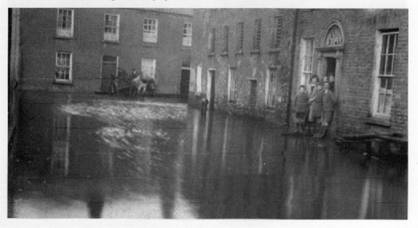 58. A scene we hope is gone forever.
Residents of John Street battle against the river Barrow as the floods
rise. Pictured are members of the Dunny family outside of their house,
this is the house that later became known to us as Donoghue's. It was
in fact part of the property given to the people of Carlow by George
Bernard Shaw. Across the road in Ballymanus Terrace we see O'Neill the
boatsman with his horse and cart reversed to the front of his house as
he prepares to move to higher ground. Note the water pump in the
centre of the picture. 58. A scene we hope is gone forever.
Residents of John Street battle against the river Barrow as the floods
rise. Pictured are members of the Dunny family outside of their house,
this is the house that later became known to us as Donoghue's. It was
in fact part of the property given to the people of Carlow by George
Bernard Shaw. Across the road in Ballymanus Terrace we see O'Neill the
boatsman with his horse and cart reversed to the front of his house as
he prepares to move to higher ground. Note the water pump in the
centre of the picture. |
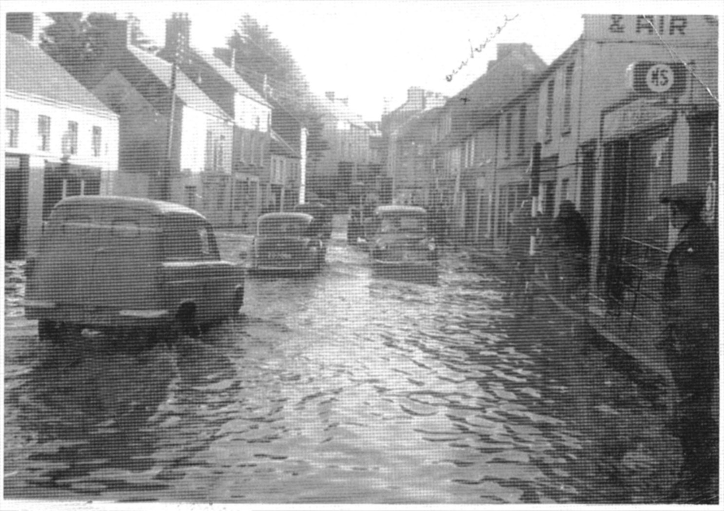 58. This scene was photographed in
1963 by Sean Swan, it shows flooding in my home street Coal Market.
Later that year following the assassination of President John R
Kennedy in Dallas, Texas, Coal Market resident and neighbour John Swan
promoted the idea to rename the street Kennedy Street and so it has
remained to this day. On our left we see 'Johnny Nails' pub with
O'Neill over the door. Up the street with the cafe sign on the wall is
'The Market Cafe'. It was owned by the Shanaghy family. The larger
house adjoining is 'The Elite Salon' run by hairdressers Hannah
Corcoran and Josie Slater. Carlow County Council along with other
groups have taken precautions to ensure that there will be no more
flooding in this area. 58. This scene was photographed in
1963 by Sean Swan, it shows flooding in my home street Coal Market.
Later that year following the assassination of President John R
Kennedy in Dallas, Texas, Coal Market resident and neighbour John Swan
promoted the idea to rename the street Kennedy Street and so it has
remained to this day. On our left we see 'Johnny Nails' pub with
O'Neill over the door. Up the street with the cafe sign on the wall is
'The Market Cafe'. It was owned by the Shanaghy family. The larger
house adjoining is 'The Elite Salon' run by hairdressers Hannah
Corcoran and Josie Slater. Carlow County Council along with other
groups have taken precautions to ensure that there will be no more
flooding in this area. |
|
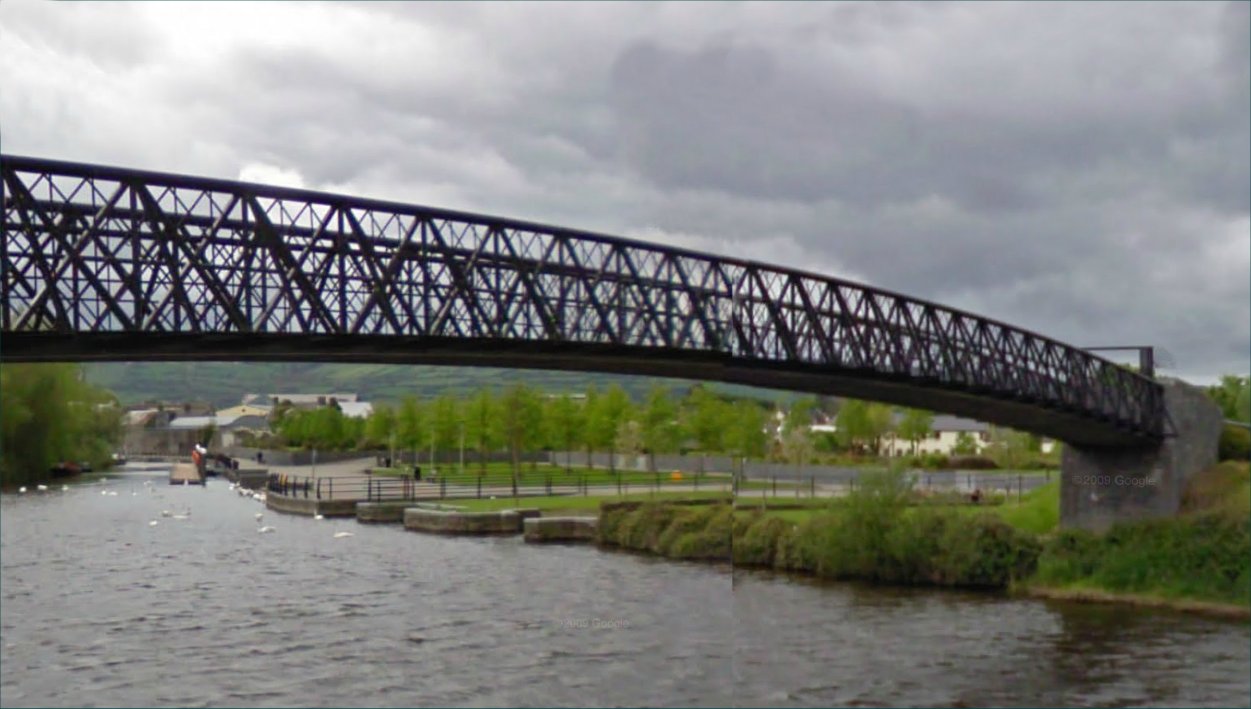
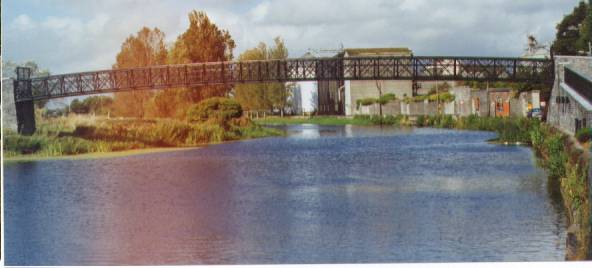 The new
Millennium Bridge across the River Barrow in Carlow New Barrow
bridge opened - 2000 The new
Millennium Bridge across the River Barrow in Carlow New Barrow
bridge opened - 2000Chairman of the National Millennium Committee Seamus Brennan was in Carlow last week to perform the official opening of the new pedestrian bridge over the River Barrow which will link Carlow town with Graiguecullen. The Millennium Bridge, which has a span of thirty-five metres and cost a total of €1m, begins at a point on the Barrow Track at the western end of Cox's Lane and the Graiguecullen side is located in the new Town Park. The Millennium Bridge has been dedicated to the memory of the former town and county councillor Jimmy "Terazzo" Murnane who died last year. |
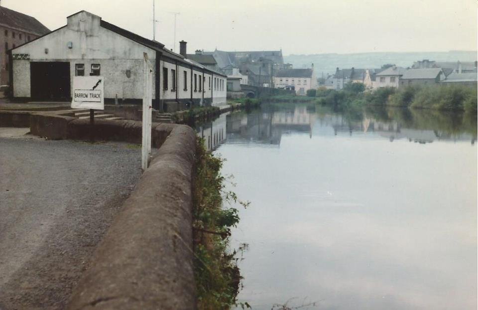
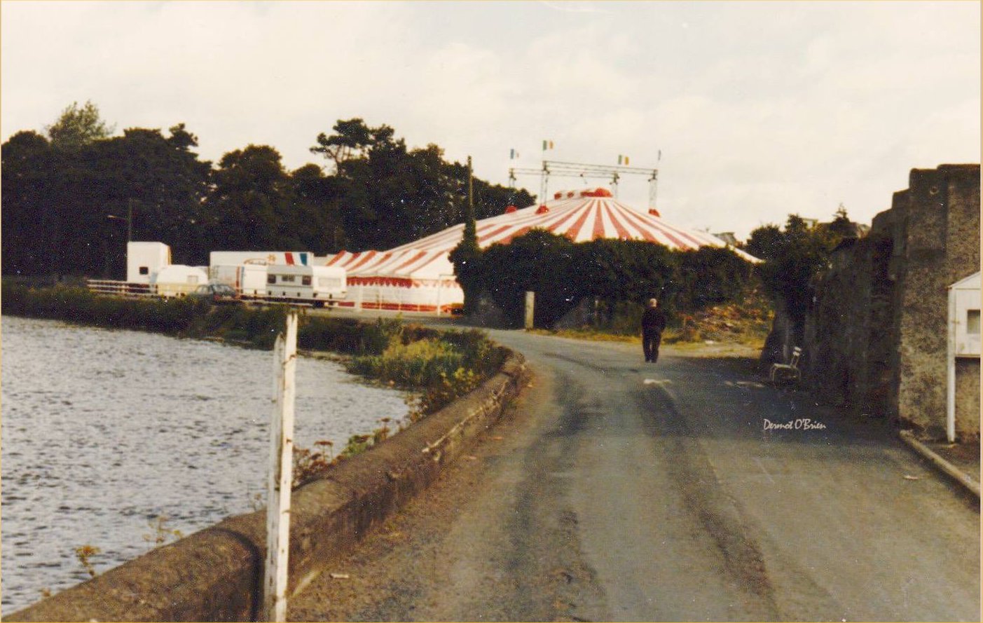 The Barrow track ran behind the Town Hall where they used to hold Faire's and the Circus in the car park. Image was found on Carlow RC Facebook page posted by Peadar Doyle 2015. |
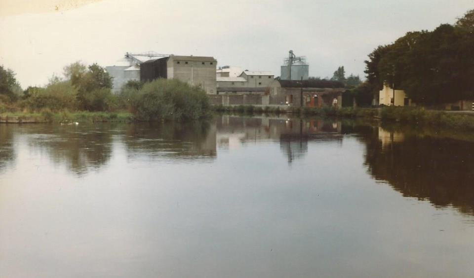
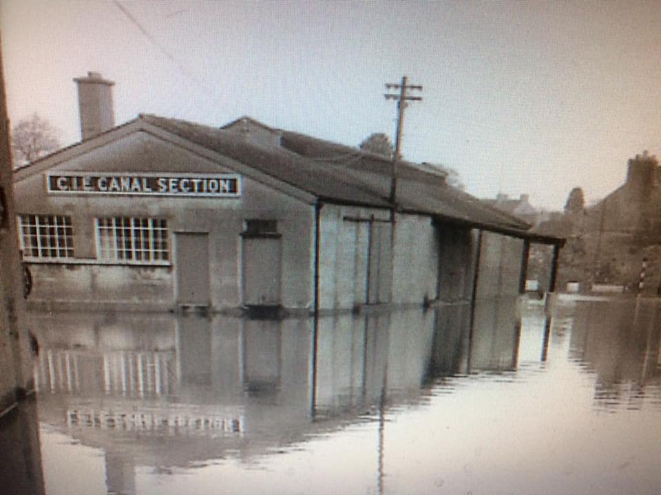 This image is of the C.I.E. Canal Section storeage shed c.1950s which later became the Carlow Rowing Club. This was during the many floods carlow sufford in this period. Image was found on Carlow RC Facebook page and was posted by Peadar Doyle 2016. |