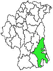
Killevy Civil Parish
County Armagh, Northern Ireland
| Civil Parish | Killevy |
| Barony | Orior Upper |
| Poor Law Union | Newry |
| Catholic Diocese | Armagh |
| Catholic Parish | Killeavy Upper* |
| Presbyterian Congregation | Bessbrook |
|
*Catholic Parish names depends on reference: *Brian Mitchell's, 'A New Atlas of Ireland: For the purpose of this website, Killeavy Upper is used. |
Search the IGP County Armagh website
|
KILLEVEY, or KILSLEVE, a
parish, partly in the barony of LOWER ORIOR, but chiefly in that of
UPPER ORIOR, county of ARMAGH, and province of ULSTER. 4 miles (W.) from
Newry; containing, exclusively of Carnlough and Meigh, 4259 inhabitants.
Including the parishes of Camlough and Meigh (which are described under
their own heads) it comprises, according to the Ordnance survey, 28,174
statute acres, of which 4191 are in Lower, and the remainder in Upper
Orior. Of these, about 21,440 are arable and pasture, 190 water, and
6300 mountain and bog. The mountain called Slieve Gullion separates this
parish from Forkhill, and rises to the height of 1893 feet above the
level of the sea. The system of agriculture has been much improved
recently. Whinstone and grey granite are extensively worked for
building, and porphyry is also found. There is a communication with
Lough Neagh by the Newry canal, and the river Bann. |
|
Do you have a description of this civil parish or a picture? If you send it/them, I will put it/them in this space. |
Townlands
Family History Library Film Numbers
| Film Title | Film number(s) |
| Tithe Applotments, 1835 | #258461 |
| Griffith's Valuation, 1864 | #258751 |
| Rental books of Lord Charlemont's Newry Estate (Armagh), 1839-1866, Rental books of the Newry estate, 1839-1850 | #258638 |
| Rental books of the Newry estates (cont.), 1850- 1866 | #258639 |
| Parochial registers of Upper Killevy and Lower Killevy (Armagh), 1832-1881; Baptisms, 1832-1880; marriages, 1832-1868, 1861-1881; deaths, 1858-1862, from upper Killevy; baptisms, and marriages, 1835-1860; baptisms, 1860-1880; deaths, 1858-1860; marriages, 1860-1862, 1868-1869, 1875; and deaths, 1860-1862, from Lower Killevy | #926042 |
| 1901 Ireland Census, D.E.D. 57/1-4 | #812101 |
| 1901 Ireland Census, D.E.D. 59/14-15 | #812102 |
| 1901 Ireland Census, D.E.D. 60/4-7, 61/1-13 | #812103 |
| 1901 Ireland Census, D.E.D. 63/1 | #812104 |
| 1901 Ireland Census, D.E.D. 65/1-14, D.E.D. 65/15-16, 18C, 17C | #812105 |
| 1901 Ireland Census, D.E.D. 66/1-11, 12C (file 1-2), 13C; 67/4-7, D.E.D. 68/19-22 | #812106 |
| 1911 Ireland Census, Ballybot D.E.D. 59/1-4 Townlands: Carnagat, Carrivekeeny, Cloghoge, Corrinshigo | #1999590 |
| 1911 Ireland Census, Latbirget D.E.D. 61/14-15 Townlands: Annacloghmullin, Carricknagalliagh | #1999607 |
| 1911 Ireland Census, Jonesborough D.E.D. 62/4-6 Townlands: Aghadavoyle, Annahaia, Carrickbroad | #1999608 |
| 1911 Ireland Census, Jonesborough D.E.D. 62/7 Townland: Drumintee | #1999609 |
| 1911 Ireland Census, Killevy D.E.D. 63/1-5 Townlands: Aghayalloge, Ballinliss, Ballintemple, Ballymacdermot, Carrivemaclone | #1999609 |
| 1911 Ireland Census, Killevy D.E.D. 63/6-11 Townlands: Clonlum, Clontygora, Ellisholding, Killeen, Meigh, Newtown | #1999610 |
| 1911 Ireland Census, Killevy D.E.D. 63/12-13 Townlands: Seafin, Tamnaghbane | #1999611 |
| 1911 Ireland Census, Belleek D.E.D. 65/1 Townland: Drumilly | #1999612 |
| 1911 Ireland Census, Camlough D.E.D. 67/1-10 Townlands: Aghmakane, Ballard, Ballynalack, Carrickbrackan, Carrickcloghan, Carrickcroppan, Clogharevan, Cross, Duburren, Duvernagh | #1999614 |
| 1911 Ireland Census, Camlough D.E.D. 67/11-17 Townlands: Eshwary, Keggall, Lislea, Lissaraw, Maghernahely, Sturgan; Carrickbracken, Bessbrook Town (Charlemont Square East through College Square West), Clogharevan | #1999615 |
| 1911 Ireland Census, Camlough 67/17, Bessbrook Town, cont. (Fountain Street throught Quarry Row) | #1999626 |
| 1911 Ireland Census, Camlough D.E.D. 67/18 Camlough Town | #1999627 |
| 1911 Ireland Census, Mullaghglass D.E.D. 68/1-6, 8-11 Townlands: Kilmonaghan, Knockduff, Serse, Cloghinny, Cloghreagh, Derrywilligan, Goragh, Latt, Maytown, Mullaghglass | #1999627 |
| 1911 Ireland Census, Mullaghglass E.D. 68/12-13; 7 Townlands: Bessbrook Town (part), Craigamore Town (includes Glasdrummond) | #1999628 |
| 1911 Ireland Census, Tullyhappy D.E.D. 69/4-7 Townlands: Crankey, Enagh, Lesh, Tullyhappy | #1999628 |
| 1911 Ireland Census, Poyntz Pass D.E.D. 70/19-22 Townlands: Drumbanagher, Killybodagh, Kilrea, Lissummon | #1999630 |
|
(before ordering films, check # for accuracy) |
| SURNAME | CONTACT |
| To add your surname | Email IGP County Armagh |
|
Information to be added:
|
|
Your help is needed. If you have anything that you think will add to this website, including records, that will help others when researching this civil parish's genealogy, please email me. |
Back to the County Armagh Land Divisions website....
Back to the County Armagh website....

©2001-2016ConnorsGenealogy,
Ireland Genealogical Projects
last updated
June 23, 2016