Graiguecullen c.1940's
This is
looking west along 98 Street and before work had started on Governey
Park.
Source of image Anna
Nolan Gough |
-

- Aerial photo showing
part of Graiguecullen showing Maryborough St, Sleaty St, 98 Street, Croppy
Graves, taken in the c.1940's. Bottom right you can still
see a houses with thatched roofs!
- Source: Peter Heary (Facebook)
|

Graiguecullen c.1940's.
This
image looking south is after work had started on Governey Park
Source of image Anna Nolan Gough |

Governey Park foundations.
Source Jim Nolan Facebook |
Killeshin Road with the Killeshin Church of
Ireland on the left and the Wood Yard on the right.
Source: Google Maps
|

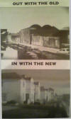
The top photo was probably taken from the
bridge looking south towards Websters Lock. The bottom photo was
probably taken from the Barrow Track looking back towards the
bridge.
Source: Pat Timmons Facebook |

Graiguecullen GAA Clubhouse under
construction c.1980's
Source of image Declan Alcock
|

Graiguecullen GAA Clubhouse under
construction c.1980's
Source of image Declan Alcock
|

Graiguecullen GAA Clubhouse under
construction c.1980's
Source of image Declan Alcock
|

The first Gas supply arrives in Chapel
Street and through Begleys Bog and Barrow Track...c.1983/84. Source:
Declan Alcock
|

St Fiacc's House, 1983
Source: Declan
Alcock
|

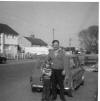
Church Street c.1960's
Photo from Esther Maher Butcher
|